Littoral​ Society

  • Home
  • What We Do
    • Conservation
    • Education
    • Advocacy
    • Fish Tagging
    • Presentations
  • Where We Work
    • Sandy Hook
    • Barnegat Bay
    • Delaware Bay
    • Jamaica Bay
    • Sarasota Bay
  • Who We Are
    • History
    • Staff
    • Officers & Trustees
    • Financial Accountability
    • Diversity, Equity, Inclusion and Justice
    • Contact
  • Newsroom
    • Littoral News
    • Press Releases
    • Videos
    • Publications
    • Reports
  • Blog
  • Join Us
    • Donate
    • Membership
    • Fish Tagging Membership
    • Sponsor
    • Upcoming Events
    • Overnight Trips
    • Volunteer
    • Jobs
  • Store

Clean Water, Beautiful Park

Explore 'Green Infrastructure' Techniques in Ocean County Park that reduce non-point source pollution entering the Metedeconk River and Barnegat Bay 
Picture

What is The Metedeconk
River Watershed
?

​All water bodies have a land area that drains to them.  We call this a watershed.  Ocean County Park is a 90 square mile sub-watershed of the Metedeconk River.  The Metedeconk River is one of many streams and rivers that flow into Barnegat Bay.  The water quality of the River and the Bay has been harmed by non-point source pollution.
Picture

What is Non-Point Source Pollution?

When it rains, storm water runoff drains from a watershed to its receiving waterway.  Human activities pollute runoff. This could be as litter, car oil, pet waste, or chemicals such as lawn fertilizers or pesticides. As watersheds have developed over the years, much of the natural land has been disturbed or paved over with asphalt and buildings. Rain water can no longer filter back into the ground and instead flows off these developed areas carrying with it pollutants that harm water quality.

What are We Doing to ImproveThe Metedeconk River Watershed?
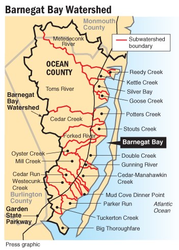
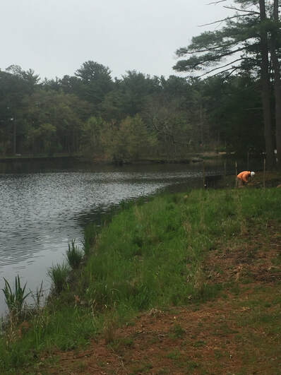
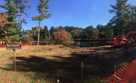
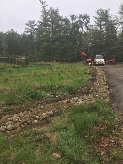
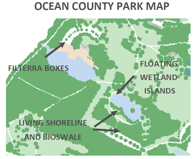
  • ​Floating Wetlands
  • Tree Boxes
  • Vegetated Bioswales
  • Living Shorelines

Where Are We Working? 

Ocean County Park, Lakewood, NJ 
Picture

What Can I Do To Help Limit Pollution?

Think about the water features while you enjoy the park today and the ways in which you can help keep it cleaner for people and wildlife. Educate yourself about how to lessen pollution or prevent it from occurring in the first place.

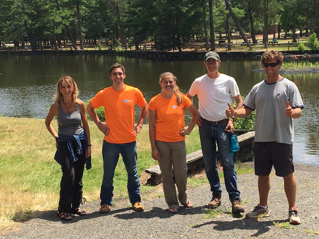
The American Littoral Society and partners will be improving the water quality in Ocean County Park through 2018 by implementing a series of “Green Infrastructure” techniques that reduce non-point source pollution entering the Metedeconk River and Barnegat Bay. These projects are built to mimic natural systems.

​We hope you will visit often to learn more about the many ways we are making a difference and join us in protecting and restoring clean water for your park, your community, your river and the Bay.

Picture
Picture

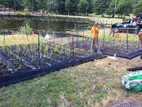
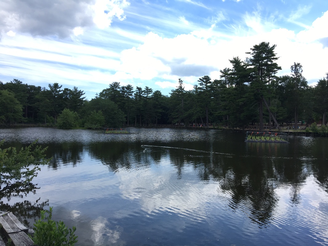
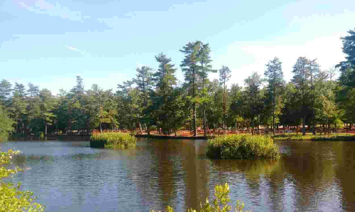
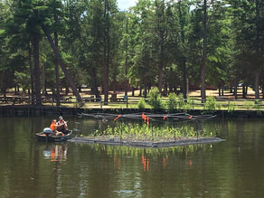
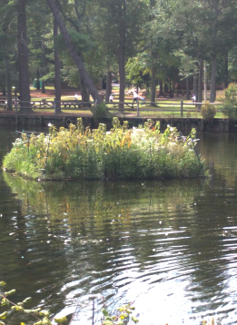
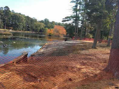
What are Floating Wetland islands?

  • Man-made wetland islands that increase habitat for fish and other aquatic organisms.
  • The islands are planted with vegetation that adds to the beauty of a pond or lake.
  • By plant filtration and uptake, they decrease the amount of pollution, helping to improve water quality.
Picture
Picture

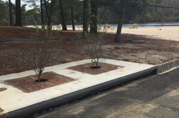
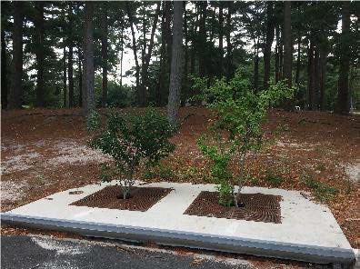
What are Tree Boxes?
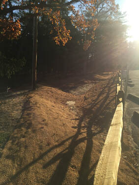
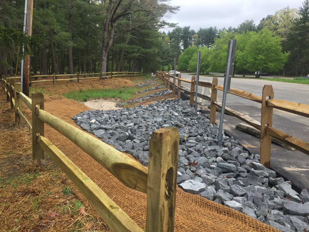
  • Built at street level, they are filled with a special soil mix and planted with indigenous trees and shrubbery.
  • Tree boxes collect runoff.  As it filters through the soil and tree roots the amount of pollutants is decreased.
Picture
Picture

Picture

​What are BIOSwales?

  • Long, shallow, man-made dips that collect runoff and allow the runoff to soak into the ground.  
  • They are planted with native plants that filter and absorb pollutants.
Picture
Picture

What is a Living Shoreline?

  • Living shorelines use a variety of native plants to filter runoff, create and improve habitat for aquatic animals, improve water quality, and protect the shoreline from erosion. 
  • At Ocean County Park, two sections of deteriorating bulkhead were removed from Duck Pond and replaced with living shorelines. 
Picture
Picture
Picture
Picture
Picture
Interested In Learning More? 
Click here to view the Ocean County Park Green Infrastructure Fact Sheet  
Click here to view the Ocean County Park Green Infrastructure Brochure   
Click here to see the Ocean County Park Green Infrastructure Educational Signage
Funding  for this project provided through a Watershed Restoration 319(h) Grant from the New Jersey Department of Environmental Protection (Grant #WM15-014)
More Photos
Picture
18 Hartshorne Drive
​Highlands, NJ 07732

What We Do

Education
Conservation
Restoration
Advocacy
Fish Tagging

Where We Work

Sandy Hook
Barnegat Bay
Delaware Bay
Jamaica Bay
Sarasota Bay
National Policy

Who We Are

History
Staff
Officers & ​Trustees
Financials
Contact

Newsroom

Blog
Press Releases
Videos
Publications
Reports

Join Us

Memberships
Donate
Sponsor
Upcoming Events
Field Trips
Volunteer
Jobs
Donate
Membership
Mailing List
Volunteer
Privacy Policy
Copyright ​© 2017, American Littoral Society, All Rights Reserved