
|
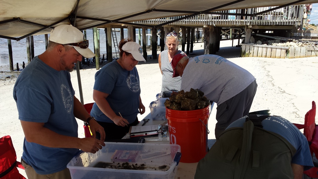
Everyday the American Littoral Society generates new data on some aspect of the coastal environment. Very often this data is synthesized into reports prepared for government agencies, educational institutions, funding agencies, or the general public. Below are some of the reports we have prepared for a variety of programs.
|
HORSESHOE CRAB TAGGING AND SURVEY REPORTS
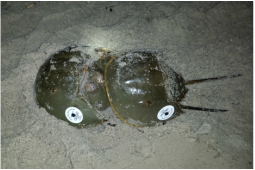
The Society runs one of the largest tagging operations within the USFWS' Cooperative Horseshoe Crab Tagging Program, deploying 4,000 tags per year in the Delaware Bay. Additionally, we collect data on spawning crabs across several Delaware Bay beaches which is used to help inform the ongoing Delaware Bay Spawning Survey.
The Society runs one of the largest tagging operations within the USFWS' Cooperative Horseshoe Crab Tagging Program, deploying 4,000 tags per year in the Delaware Bay. Additionally, we collect data on spawning crabs across several Delaware Bay beaches which is used to help inform the ongoing Delaware Bay Spawning Survey.
WRECK POND MONITORING REPORTS
Monitoring of fish in Wreck Pond has occurred since 2006. In addition, a habitat assessment was conducted in 2015. Click on the link below to read reports regarding our work at Wreck Pond.
Monitoring of fish in Wreck Pond has occurred since 2006. In addition, a habitat assessment was conducted in 2015. Click on the link below to read reports regarding our work at Wreck Pond.
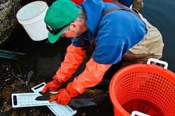
FISH TAGGING DATA
These reports contain the data for our annual tagging returns, The returns are arranged in alphabetical order by species. In the left-hand columns we show when, where, and who originally tagged the fish, and the length of the fish when it was tagged. In the right-hand columns we show when, where, and by whom the fish was recaptured, and the length at the time of recapture.
These reports contain the data for our annual tagging returns, The returns are arranged in alphabetical order by species. In the left-hand columns we show when, where, and who originally tagged the fish, and the length of the fish when it was tagged. In the right-hand columns we show when, where, and by whom the fish was recaptured, and the length at the time of recapture.