
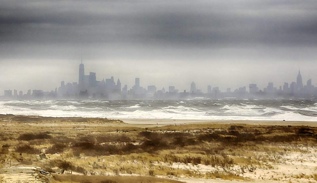
 A nor’easter hammered the east coast from the Delmarva Peninsula to Maine on January 23-24. The weather event spawned winds in excess of 60 mph in New Jersey, along with torrential rain, rough surf and coastal flooding throughout the regions. The American Littoral Society has been working for years on projects intended to protect beaches and restore wetlands. In the Delaware Bay area of New Jersey the Society has been constructing off-shore reefs designed to lessen the force of waves hitting the shore and reduce the effects of storm surge. In Spring Lake, NJ the Society just finished construction of a fish passage that will not only improve water quality in a coastal lake, but also reduce flooding the surrounding communities. In New York City's Jamaica Bay, the Society has been rebuilding saltmarshes because they protect the mainland as a buffer against coastal storms and flooding. Both reefs and marshes also provide excellent homes for all sorts of wildlife. The day after the storm, American Littoral Society staff visited restoration sites around Delaware and Jamaica bays, and Spring Lake's Wreck Pond to see how things held up and gauge whether the work help provide any protection. 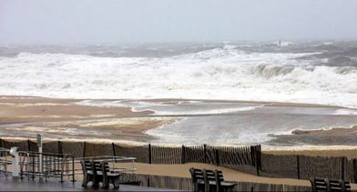 On the drive to sites in the Delaware Bay region, the evidence of the storm was easy to see, with many downed trees and rack lines of debris deposited across roads from flood waters. It appeared that some flooding came from the surrounding marshes. Water ponding along the road edges was also present in places. No obvious damage to homes in the community could be seen. The Society assessed Kimbles Beach and south Reeds Beach in Cape May County and Thompsons Beach in Cumberland County. Kimbles and Reeds beaches have a general north-south orientation to the bay while Thompsons has a general east-west orientation to the bay. These differing orientations can result in very different damage from storms. None of the restored beaches visited by Society staff appeared to have suffered any significant sand loss or scarping. We believe that storm’s general easterly wind direction may have helped minimize damage to beaches and properties on the Delaware Bay as the wind would be blowing the tide out into the bay. We attempted to inspect our intertidal reef at south Reed’s Beach but a steady westerly wind kept the reef underwater. The informational sign installed at Reeds Beach evidently could not hold up against the wind as it had been ripped from the metal support posts. The sign was nowhere to be found. Additional site visits are planned to assess each project site. Reduced flooding is one of the goals for the new fish passage at Spring Lake, NJ's Wreck Pond. Because the culvert can be opened and closed, it can be strategically managed during storm events. When open, the culvert allows for large amounts of water to exit the watershed during heavy rains. When closed, the culvert can prevent storm surge from entering the pond. The recent nor’easter was the first large storm to hit Wreck Pond since the completion of the culvert. The culvert gate was closed at noon on Monday in response to the large storm surge. An American Littoral Society staff scientist arrived at the pond near 3:00 p.m. on Monday to observe the status of the pond. At that point, it was mildly raining, and the water level in the pond was higher than normal. There were very strong winds blowing on-shore, with 10-12 foot seas. Water could be seen surging at least half way up the beach toward the pond. The water level in the pond continued to rise Monday and Monday night as the rain intensified, but water never overflowed the banks. The culvert was opened Tuesday morning to allow storm water that had collected in the pond overnight to flow out into the Ocean. Water level dataloggers are currently installed in the pond, and when collected next month, they will be able to provide accurate details as to the height, temperature, and salinity of the water in the pond over the course of the storm. 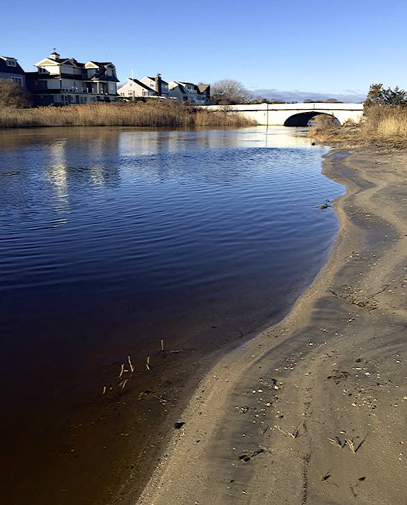 However, from observations by Society staff and local residents, we do know that Wreck Pond did not flood during the storm. Pictures taken Wednesday morning show a calmer ocean and pond. Water continues to flow from the pond into the ocean.
In Jamaica Bay sustained winds reached 50-60 mph. Widespread city warnings had schools closing early and local bridges reduced to single lanes. The combination of Northeast winds and high tide put vulnerable communities, especially those on the westward facing shorelines of Broad Channel at risk. The restored marshes proved to be a protection to the community by dissipating wave energy. Historically, wind gusts would create dangerous and damaging wave conditions. Although the Broad Channel community experienced flooding from the rain and tide, the restored marshes reduced wave energy and protected the community from far more serious damage. You can help support the American Littoral Society's efforts to protect coastal areas through restoration and conservation of natural barriers. Go to the Littoral Society Volunteer page to find upcoming opportunities or sign-up for emails from the Society to receive notifications of our events and other activities. You can also go to the Memberships page to learn the benefits of joining the Society or the Donate page to see how you can contribute to the Littoral Society's continuing coastal work. Comments are closed.
|
Archives
July 2024
Categories
All
|
