
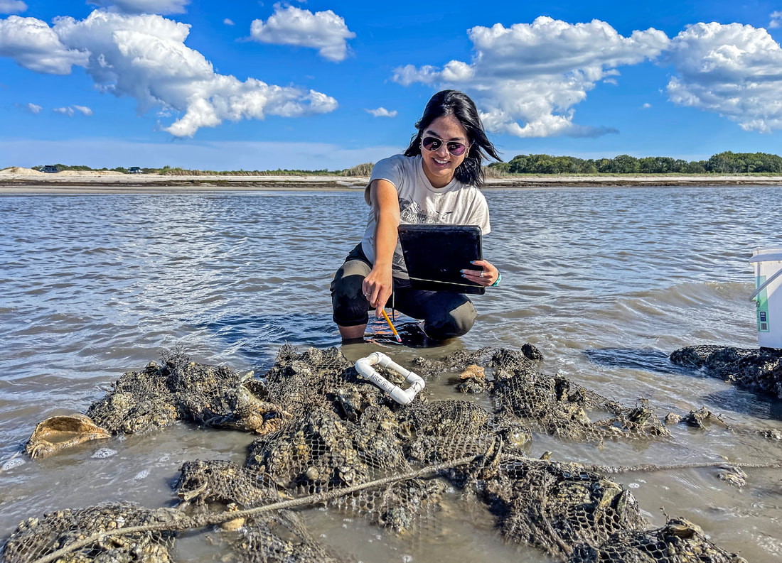
 by Toni Rose Tablante, American Littoral Society Habitat Restoration Technician The Delaware Bay is home to the largest population of spawning horseshoe crabs [Limulus polyphemus] in the world. The crabs are a keystone species because they and their eggs are crucial to an entire ecosystem that includes migrating shorebirds, various fish, numerous aquatic invertebrates, and other marine life. The American Littoral Society has been restoring horseshoe crab habitats along the New Jersey side of the Delaware Bay since Hurricane Sandy hit in 2012. The work also includes biological assessments at some beaches to help document how the work is affecting the restoration site and aquatic creatures. The 2023 reef biodiversity monitoring season recently began. Read on to learn more about the monitoring process. 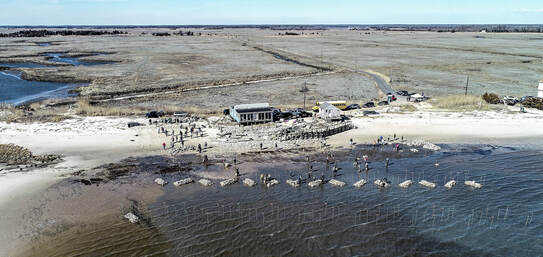 Reef construction at Dyers Cove Reef construction at Dyers Cove Since restoration work began along New jersey’s Delaware Bayshore, the Society and partners have restored eight beaches in the Delaware Bay – Dyers Cove, Fortescue, Thompsons, and Moores in Cumberland County, and Reeds, Cooks, Kimbles, and Pierces Point in Cape May County. A series of intertidal reefs were created at five of the restored beaches – Dyers Cove, Thompsons, Moores, Cooks, and Reeds Beaches. Monitoring components implemented to test the effectiveness of the reefs include wave attenuation to monitor wave energy, three dimensional scans of the shoreline provided by the Stockton Coastal Research Center to observe littoral drift and determine sand accretion, and biological assessments to determine fish use and habitat for benthic invertebrates. The southern end of Reeds Beach, located in Middle Township, Cape May County, NJ was restored in 2013 and 2014, with intertidal reef construction in 2015. Cooks Beach, located in Middle Township, Cape May County, NJ was restored in 2015 and received several follow up sand placements. Intertidal reef construction took place in 2019 and was completed in 2020. The reef segments were created by stacking shell bags loaded with cured whelk shell. Cooks Beach has fifteen inshore and offshore reef blocks, while Reeds Beach has fifteen inshore and eight offshore reef blocks. 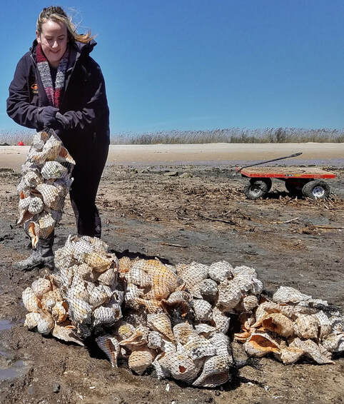 Shell bags at Thompsons Beach Shell bags at Thompsons Beach High-density polyethylene netting is used for the bags containing the shells, but we are currently experimenting with alternative materials for future restoration projects. The reef design varies between each location due to the unique characteristics of each beach and nearby properties. As the Habitat Restoration Technician, it is one of my responsibilities to monitor our restoration projects post-construction. From August to November, I monitor the shell bag reefs for the diversity and abundance of benthic epifauna. 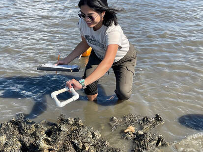 At low tide, I walk out to two randomly selected reef blocks and assess the top layer of each using a 10 cm2 quadrat (essentially a square made of PVC pipe which can be laid over the reef to define the sampling area). This is done for both the inshore and offshore segments. Any encrusting organisms found within the quadrats are counted and measured for length using a caliper. I also randomly select 3 whelk shells from the reef block to look for any mobile organisms living on/in the shells. I rinse the shells over graduated sieves and identify the organisms. A subsample of five individuals is measured for each species. To complement our low-tide sampling, we implement high-tide sampling as well. Between the months of August and November, demersal fish monitoring occurs at the intertidal reefs adjacent to Cooks and Reeds beaches. We access the reefs and process all traps using our 19-foot Carolina Skiff. Using oval fish traps, nine traps are deployed 2 hours before high tide – 3 inshore, 3 offshore, and 3 controls. After soaking for 4 hours, 3 inshore and 1 control trap are pulled and processed. The remaining traps – 3 offshore and 2 controls – are pulled and processed after 24 hours to ensure the traps are exposed to a full tide cycle. Once pulled onto the boat, traps are opened and emptied into sorting bins to be processed. All fish and crab species are identified, weighed, measured, and photographed. Weight and length are determined using a spring scale and fish board. All species are returned alive within the vicinity of the reef after being processed. This process is then repeated the following day after a 24-hour soak for the remaining traps. Environmental monitoring occurs for both low and high-tide sampling, which includes water temperature, salinity, turbidity, wind speed and direction, precipitation amount in the last 24 hours, cloud cover, and air temperature. Tools used to measure these parameters include a centigrade thermometer, refractometer, Secci disk, Kestrel wind and temperature meter, and directional compass. The most prominent encrusting organisms living on or around our shell bag reefs are striped anemones (Haliplanella luciae), barnacles (Balanus spp.) and oysters (Crassostrea virginica). Also found around our reefs are spot croakers (Leiostomus xanthurus), silver perch (Bairdiella chrysoura), and Atlantic blue claw crabs (Callinectus sapidus). While we won’t have results from current monitoring until nearer the end of the year, previous assessments yielded promising results. Stay tuned for a monitoring update at the conclusion of our season at the end of November 2023! Comments are closed.
|
Archives
July 2024
Categories
All
|
